Project proponents: Georges River Council
Location: Carss Bush Park, along the western foreshore of Kogarah Bay (part of the Georges River). Georges River local government area / Eora
Coastal management area(s): Coastal environment area and coastal use area
Carss Bush Park is a public reserve that provides a scenic recreational space with great amenity. The park has local heritage significance and includes Carss Cottage, which is a state heritage listed item.
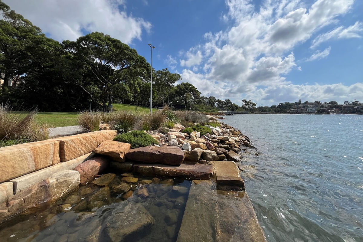
The Carss Bush Park Foreshore Naturalisation project focussed on upgrading an existing vertical seawall while improving water quality and increasing habitat. This involved replacing some parts of the seawall with an environmentally friendly seawall that creates habitat for sea life, while the remaining sections were adapted into salt marsh benches.
By returning the foreshore to a more natural state, the project supports species migration along the Georges River and improves biodiversity throughout the estuarine environment.
The project offers protection from erosion, while maintaining public access and amenity through active transport links.
NSW Coastal Design Guidelines application
This case study shows how you can apply chapter 4.2 ‘Design guidance for the natural environment’ from the NSW Coastal Design Guidelines 2023 (PDF, 9.2 MB).
Objectives
4.2.1 Base considerations on a hierarchy of landform, then landscape, then built form.
The organic foreshore shape reinforces the natural landform and creates a gradual transition from the water to the land. The project prioritised enhancing public amenity and access, reintroducing coastal processes and creating mudflats, rockpools and other habitat structures. Given the limited project area, this meant that the amount of riparian vegetation planted next to the shared pathway needed to be limited.
4.2.2 Protect and enhance water quality, hydrological systems and coastal processes
The project restored natural tidal processes that had been disturbed by the concrete seawall, which had also reached end of life. The removal of the seawall has reduced sediment entering the river, improving water quality. Sandstone logs and rubble were used to create wide, sloping surfaces for new rocky intertidal habitats and to protect the shoreline from erosion. The project used water-sensitive urban design principles to expand natural drainage patterns.
4.2.3 Identify, protect and enhance sensitive coastal ecosystems and threatened ecological communities
The community boardwalk and vegetation setback act as a barrier to protect the new habitats constructed as part of the project. The project protects habitat zones on the riverbed and ecosystems such as the Kogarah Bay seagrass community. The project reconnects a fragmented landscape and improves its natural characteristics.
4.2.4 Ensure that the natural coastal environment is integrated into built coastal environments
The landscaping allows the migration of sand, intertidal fauna and self-sown mangroves. The project features a continuous shared pathway that connects to an overwater boardwalk, which facilitates community use of the area. The landscaping features were also designed for the community to enjoy, promoting public use of the foreshore. There is endangered vegetation normally found along rivers and shorelines next to the shared-use path.
4.2.5 Use nature-based solutions as the first option to address environmental challenges, avoiding hard engineering solutions where possible
The project adopted principles from the Environmentally Friendly Seawalls Guide. This includes:
- constructing saltmarsh benches from the demolished concrete seawall, which will allow algae to establish
- creating mudflats that will become homes to estuarine ecosystems by re-naturalising the area
- using sandstone logs to create rocky intertidal habitat
- creating rockpools that hold water during low tide and provide a home for fish and invertebrate species.
