Cultural Fire Management Unit
The Buugang Wambal project

- Advertising and signage
- Alpine resorts
- Building systems circulars
-
- Apartment Design Guide
- Better apartments
-
- Boarding houses and co‑living housing
- Build-to-rent housing
- Caravan parks, manufactured home estates and moveable dwellings
- Group homes
- In-fill affordable housing
- Retention of existing affordable housing
- Secondary dwellings
- Seniors housing
- Social and affordable housing
- Supportive accommodation and temporary housing
- Housing Support Program
-
- Bayside Council’s housing snapshot
- Frequently asked questions
- Blacktown Council’s housing snapshot
- Blue Mountains Council’s housing snapshot
- Burwood Council’s housing snapshot
- Camden Council’s housing snapshot
- Campbelltown Council’s housing snapshot
- Canada Bay Council’s housing snapshot
- Canterbury-Bankstown Council’s housing snapshot
- Central Coast Council’s housing snapshot
- Cessnock Council’s housing snapshot
- Cumberland Council’s housing snapshot
- Fairfield Council’s housing snapshot
- Georges River Council’s housing snapshot
- Hawkesbury Council’s housing snapshot
- Hornsby Council’s housing snapshot
- How we developed the targets
- Hunters Hill Council’s housing snapshot
- Inner West Council’s housing snapshot
- Kiama Council’s housing snapshot
- Ku-ring-gai Council’s housing snapshot
- Lake Macquarie Council’s housing snapshot
- Lane Cove Council’s housing snapshot
- Liverpool Council’s housing snapshot
- Maitland Council’s housing snapshot
- Mosman Council’s housing snapshot
- Newcastle Council’s housing snapshot
- North Sydney Council’s housing snapshot
- Northern Beaches Council’s housing snapshot
- Parramatta Council’s housing snapshot
- Penrith Council’s housing snapshot
- Port Stephens Council’s housing snapshot
- Randwick Council’s housing snapshot
- Ryde Council’s housing snapshot
- Shellharbour Council’s housing snapshot
- Shoalhaven Council’s housing snapshot
- Strathfield Council’s housing snapshot
- Sutherland Council’s housing snapshot
- Sydney Council’s housing snapshot
- The Hills Council’s housing snapshot
- Waverley Council’s housing snapshot
- Willoughby Council’s housing snapshot
- Wollondilly Council’s housing snapshot
- Wollongong Council’s housing snapshot
- Woollahra Council’s housing snapshot
- Inland Code
- Pre-sale Finance Guarantee
- Social housing
-
-
-
-
- Ten simple tips for more inclusive playspaces
- A sensory explosion
- Bowraville Children’s Playspace
- Civic Park Playspace, Warragamba
- Cook Reserve Playspace
- Livvi’s Place, Wagga Wagga
- Livvi’s Place, Warragamba
- Lot Stafford Playspace
- Masterplanned communities
- Melaleuca Village Lake Playspace
- Muston Park Playspace
- St Peters Fences Playspace
- Town Beach Playspace
- Tumbalong Park Playspace
- Waitara Park Playspace
- Wild Play Garden
- Everyone Can Play grant
- Our principles
-
- NSW regional outdoor survey
- Synthetic turf for sports fields
- The Greater Sydney Outdoors Study
-
-
- Concurrence and referral reforms
- Employment land strategies
- Employment lands
- Employment zones reform
- Engagement and concierge
- Estimated development cost
- NSW Public Spaces Legacy Program
- Planning Reform Action Plan
- Planning pathways for cemeteries
- Priority Assessment Program
- State significant development warehouses and data centres
The Cultural Fire Management Unit supports 10 Aboriginal community-led projects in NSW. These projects embed traditional knowledge in land management practices, including the use of cultural fire. They also provide evidence that will help to develop a statewide cultural fire management strategy. Aboriginal land management programs, including those that incorporate cultural burning, have the potential to provide social, economic and cultural benefits in addition to their environmental outcomes.
The Cultural Fire Management Unit was formed after the inquiry into the 2019–20 bushfires recommended the NSW Government adopt traditional Aboriginal land management practices in partnership with Aboriginal communities. Cultural burning is one component of a broader cultural approach to respectful, collaborative and effective land management practices in planning and preparing for bushfire. The approach simultaneously serves to heal Country and make it healthier in the long term.
The Buugang Wambal project
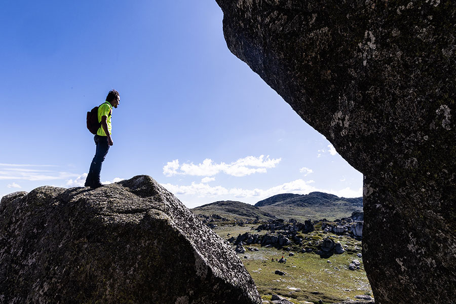
The Buugang Wambal project is a collaborative conservation effort led by the Walgalu and Wiradjuri people. The project will protect 3 critically endangered species in the Tumut and Snowy Mountains areas.
The project is one of 10 supported by our Cultural Fire Management Unit. The unit facilitates local Aboriginal communities getting on Country to incorporate traditional knowledge in land management practices on traditional lands and waters.

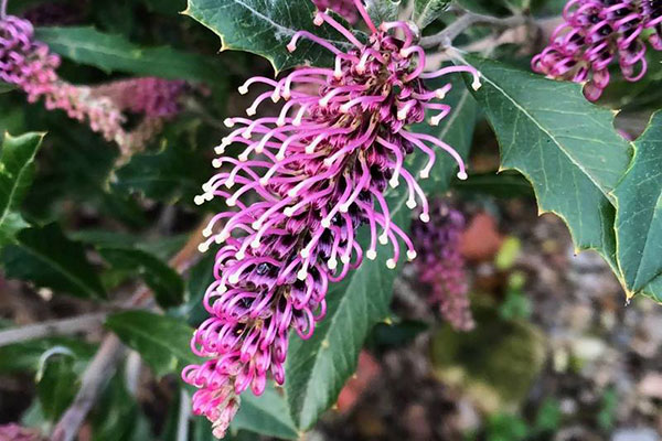
The Tumut grevillea
Local Walgalu-Wiradjuri women are leading efforts to conserve the Tumut grevillea, which grows sparingly in a narrow stretch of land around Tumut. The grevillea is culturally significant to the women of the local Aboriginal community because it typically grows in and around women’s sites.
Conservation work has involved collecting seeds from plants in the Tumut area and planting seedlings on Crown reserves. These efforts demonstrate how environmental outcomes are improved when Aboriginal communities are connected to Country.

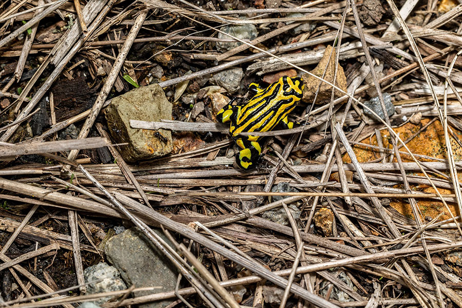
Corroboree frogs
Walgalu-Wiradjuri men are working to save the northern and southern corroboree frogs that reside in alpine areas of the Snowy Mountains. Some of the most visually stunning frog species in the world, the ‘gyak’ also hold great cultural value for the local Aboriginal community. Local Aboriginal groups would call out to the frogs before approaching the Bogong moth caves and would only proceed if the frogs granted permission by calling back.
The men have constructed artificial habitats for the frogs, which have been repaired and improved following bushfire damage. The project has also partnered with Taronga Zoo to release frogs bred in captivity into the wild.
