Roads to Home empowers Aboriginal communities to make decisions about construction of powerlines, roads and other infrastructure on Aboriginal-owned land.
How does Roads to Home work?
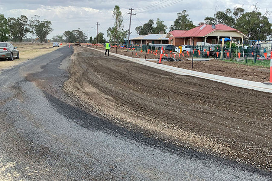
Aboriginal communities prioritise the works they need done to improve quality of life. By working with the community to resurface a main street, for example, Roads to Home has knock-on benefits such as:
- better household waste collection
- more reliable postal delivery
- access for emergency vehicles
- improved community transport.
The program also helps with long-term solutions for maintaining infrastructure in partner communities.
Training and employment opportunities for Aboriginal people
Local Aboriginal Land Councils stress the importance of local training and job opportunities for their communities. Roads to Home partners with TAFE NSW, registered training organisations and Yarpa NSW Indigenous Business and Employment hub to provide these.
From 2023, about 50 Aboriginal people have had training and job opportunities through the program in their local area. Twenty-five Aboriginal liaison officers have been employed through the program.
How many communities are working with Roads to Home?
The NSW Government has committed $109 million to upgrade infrastructure and services for 34 Aboriginal communities across the state.
The program began in July 2019 with 10 communities, followed by 11 more in 2021.
The program included another 13 communities in February 2022.
| Local Aboriginal Land Council | Community | Location |
|---|---|---|
| Balranald | Balranald Reserve (Endeavour Drive) | Balranald |
| Dareton | Namatjira Avenue and New Merinee | Dareton |
| Kempsey | Fig Tree and New Burnt Bridge | South West Rocks and Kempsey |
| Moree | Mehi Village and Stanley Village | Moree |
| Muli Muli | Muli Muli | Muli Muli |
| Thunngutti | Bellbrook | Bellbrook |
| Wilcannia | Mallee and Warrali Mission | Wilcannia |
| Local Aboriginal Land Council | Community | Location |
|---|---|---|
| Birrigan Gargle | Pippi Beach (Nyguru Village) | Yamba |
| Bogal | Box Ridge Reserve | Box Ridge |
| Brungle Tumut | Brungle | Brungle |
| Coffs Harbour | Wongala | Coffs Harbour |
| Collarenebri | Collarenebri Reserve (The Walli) | Collarenebri |
| Condobolin | Boona Road and Willow Bend | Condobolin |
| Jerrinja | Orient Point | Orient Point |
| Peak Hill | Peak Hill Reserve | Peak Hill |
| Purfleet Taree | Purfleet | Purfleet |
| Wellington | Nanima Reserve | Wellington |
| Local Aboriginal Land Council | Community | Location |
|---|---|---|
| Armidale | Narwan Village | Armidale |
| Bowraville | Bowraville | Bowraville |
| Forster | Cabarita | Forster |
| Griffith | Three Ways | Griffith |
| La Perouse | La Perouse | La Perouse |
| Merrimans | Wallaga Lake (Koori Village) | Wallaga Lake |
| Nambucca Heads | Bellwood | Nambucca Heads |
| Walgett | Gingie Reserve and Namoi Reserve | Walgett |
| Weilwan | Gulargambone Mission | Weilwan |
What has the program achieved so far?
Roads to Home has delivered upgraded infrastructure for the Bowraville, Gulargambone and Forster communities.
Bowraville Reserve
Roads to Home worked with the community of Bowraville Reserve to deliver more than $2.2 million in upgrades to infrastructure and services.
These upgrades included:
- repaving roads
- installing kerbs, guttering, stormwater drains and other drainage
- upgrading street and public area lighting
- connecting sewerage, electrical works and new water meters.
The community celebrated the completion of works in December 2020.
Gulargambone Top
Roads to Home worked with the Weilwan people of Gulargambone Top to deliver more than $1.6 million in infrastructure upgrades.
The upgrades included:
- paving roads
- installing kerbs, guttering, stormwater drains, other drainage
- installing street and public lighting.
In October 2020, other activities began, such as:
- building a new laneway with solar lighting, new culverts and drainage
- upgrading kerbs and guttering
- planting trees and landscaping.
Cabarita Reserve
Roads to Home worked with the Worimi community to deliver around $3.5 million in upgrades to the Cabarita Reserve near Forster.
The upgrades included:
- laying footpaths
- building bioretention basins
- sealing a road
- installing street lighting and stormwater drains
- upgrading wetlands
- landscaping.
The residents can now have mail delivered directly to their homes and move safely around the community. The program is now helping the community to build a new playground.
Several community members also completed TAFE civil construction qualifications and 10 local trainees worked on the project.
Program evaluation
We procured the services of Clear Horizon Consulting Pty Ltd to evaluate the Roads to Home program. The evaluation assessed how effective the program has been in delivering the intended outcomes.
The evaluation drew on existing program documentation. Clear Horizon Consulting also:
- visited communities
- held semi-structured interviews
- held a group interview with the Discrete Aboriginal Communities Executive Steering Committee
- surveyed the Roads to Home program team.
The scope of the evaluation included 4 discrete Aboriginal communities within Tranche 1 of the Roads to Home program. These were Gulargambone, Gingie, Namoi and Cabarita.
The evaluation sought to answer:
- In what ways has the Roads to Home program increased the number and quality of essential services in the participating communities?
- How have employment and social outcomes been improved?
- In what ways have the local Aboriginal Land Council’s financial and project management confidence and capability improved?
- What were the unintended outcomes of the program?
Read the Roads to Home Outcome Evaluation – Findings and Recommendations Summary (PDF, 338 KB).
For more information email the team at [email protected]


