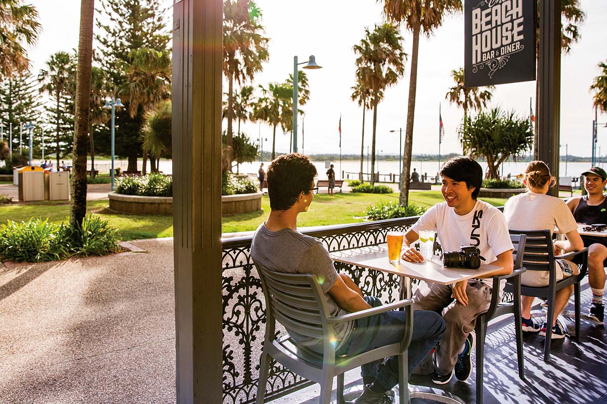
Outdoor dining
-
- A Metropolis of Three Cities
-
- Bankstown
- Bayside West Precincts
- Burwood, Strathfield and Homebush
- Camellia-Rosehill
- Carter Street
- Cherrybrook Precinct
- Church Street North
- Circular Quay Renewal
- Explorer Street, Eveleigh
- Frenchs Forest
- Greater Parramatta and Olympic Peninsula
- Greater Penrith to Eastern Creek
- Hornsby
- Independent Community Commissioner
- Ingleside
- Macquarie Park
- Narrabri
-
- North West Growth Area Implementation Plan
- Alex Avenue
- Box Hill and Box Hill Industrial
- Colebee
- Marsden Park Industrial
- Marsden Park North
- Marsden Park
- North Kellyville
- Riverstone East
- Riverstone Town Centre
- Riverstone West
- Riverstone
- Schofields Town Centre
- Schofields
- Shanes Park
- Tallawong Station
- Townson Road
- West Schofields
- Historical documents
- Northern Beaches Aboriginal Land
- Orchard Hills
- Parramatta CBD
- Penrith Lakes
- Pyrmont Peninsula
- Rhodes
- Riverwood
- Seven Hills
- South Eveleigh Train Workshop
- Telopea
-
- Aerotropolis Core, Badgerys Creek and Wianamatta-South Creek precincts
- Agribusiness precinct
- Luddenham Village Interim Strategy
- Master planning in the Aerotropolis
- Northern Gateway precinct
- The planning pathway
- Western Sydney Aerotropolis Development Control Plan
- Western Sydney Aerotropolis Explanation of Intended Effect
- Western Sydney Aerotropolis explained
- Westmead
- Wianamatta South Creek
-
- Technical assurance panel
- Urban Design for Regional NSW
-
-
- Artificial Intelligence in NSW Planning
- Assessment reports independent review
- Design guidance
- Environmental Impact Statement guidelines
- Environmental matters
- Faster Local Assessment Grant Program
- Geographic areas
- Sydney Planning Panels
-
-
- Business parks
- Commercial activity and outlook
-
- Central Coast Employment Land Precincts Map
- Central Coast Total Employment Lands Map
- Greater Sydney Employment Land Precincts Map
- Greater Sydney Total Zoned Employment Lands Map
- Hunter Metro Region Total Zoned Employment Lands Map
- Hunter Region Total Zoned Employment Lands Map
- Illawarra-Shoalhaven Region Total Zoned Employment Lands Map
- Regional NSW Zoned Employment Lands Map
- Planning performance
- Urban Development Program
-
-
- Advertising and signage
- Alpine resorts
- Building systems circulars
-
- Apartment Design Guide
- Better apartments
-
- Boarding houses and co‑living housing
- Build-to-rent housing
- Caravan parks, manufactured home estates and moveable dwellings
- Group homes
- In-fill affordable housing
- Retention of existing affordable housing
- Secondary dwellings
- Seniors housing
- Social and affordable housing
- Supportive accommodation and temporary housing
-
- Bayside Council’s housing snapshot
- Blacktown Council’s housing snapshot
- Blue Mountains Council’s housing snapshot
- Burwood Council’s housing snapshot
- Camden Council’s housing snapshot
- Campbelltown Council’s housing snapshot
- Canada Bay Council’s housing snapshot
- Canterbury-Bankstown Council’s housing snapshot
- Central Coast Council’s housing snapshot
- Cessnock Council’s housing snapshot
- Cumberland Council’s housing snapshot
- Fairfield Council’s housing snapshot
- Frequently asked questions
- Georges River Council’s housing snapshot
- Hawkesbury Council’s housing snapshot
- Hornsby Council’s housing snapshot
- How we developed the targets
- Hunters Hill Council’s housing snapshot
- Inner West Council’s housing snapshot
- Kiama Council’s housing snapshot
- Ku-ring-gai Council’s housing snapshot
- Lake Macquarie Council’s housing snapshot
- Lane Cove Council’s housing snapshot
- Liverpool Council’s housing snapshot
- Maitland Council’s housing snapshot
- Mosman Council’s housing snapshot
- Newcastle Council’s housing snapshot
- North Sydney Council’s housing snapshot
- Northern Beaches Council’s housing snapshot
- Parramatta Council’s housing snapshot
- Penrith Council’s housing snapshot
- Port Stephens Council’s housing snapshot
- Randwick Council’s housing snapshot
- Ryde Council’s housing snapshot
- Shellharbour Council’s housing snapshot
- Shoalhaven Council’s housing snapshot
- Strathfield Council’s housing snapshot
- Sutherland Council’s housing snapshot
- Sydney Council’s housing snapshot
- The Hills Council’s housing snapshot
- Waverley Council’s housing snapshot
- Willoughby Council’s housing snapshot
- Wollondilly Council’s housing snapshot
- Wollongong Council’s housing snapshot
- Woollahra Council’s housing snapshot
- Inland Code
- Social housing
-
-
-
-
- A sensory explosion
- Bowraville Children’s Playspace
- Civic Park Playspace, Warragamba
- Cook Reserve Playspace
- Livvi’s Place, Wagga Wagga
- Livvi’s Place, Warragamba
- Lot Stafford Playspace
- Masterplanned communities
- Melaleuca Village Lake Playspace
- Muston Park Playspace
- St Peters Fences Playspace
- Ten simple tips for more inclusive playspaces
- Town Beach Playspace
- Tumbalong Park Playspace
- Waitara Park Playspace
- Wild Play Garden
- Everyone Can Play grant
- Our principles
-
- Synthetic turf study
- NSW regional outdoor survey
- The Greater Sydney Outdoors Study
-
- News
NSW has the perfect climate for outdoor dining, bringing life to our streets and public spaces. Outdoor dining gives people a way to reconnect and socialise.
The NSW Government's new vibrancy reforms will permanently relax the rules for outdoor dining, allowing venues to make the most of their outdoor space with a quicker, light-touch application process.
Councils can identify outdoor dining areas as exempt development on footways or public open space at:
- entertainment, arts or cultural venues
- licensed premises or other lawful food and drink premises
- parking spaces and on temporary roads closures.
Read the Liquor Act 2007 for more details.
Businesses that meet the Codes State Environmental Planning Policy's (SEPP) exempt criteria can offer outdoor dining as exempt development on:
- the footpath or public open space, subject to a permit issued by the local council
- on private land with the landowner's permission
- at registered clubs.
See below for more information for your business.
The exempt development pathways introduced during the COVID crisis for outdoor dining on private land and at registered clubs have been made permanent. From 1 January 2024, registered clubs, food and drink premises, and artisan food and drink industries are able to use their private land and car parking spaces for outdoor dining as exempt development. New development standards have been included to maintain patron safety and accessibility.
See the Codes SEPP for more details on the development standards that apply to private land and registered clubs.
The exempt measures allow more outdoor space but do not allow a venue to increase its maximum patron capacity. See below for our proposed changes to patron capacity.
How do businesses apply?
Footpaths and roads
The State Environmental Planning Policy (Exempt and Complying Development Codes) 2008 (Codes SEPP) allows food and drink premises such as cafes, restaurants, pubs and small bars across the state to have outdoor dining on the footpath as exempt development.
This means hospitality businesses can apply to council to use the footpath and public spaces to serve diners outside without needing a separate development application. Instead, councils issue permits approved under the Local Government Act or Roads Act.
Footpaths and roads
Venue owners must obtain the landowner’s consent to use the land for outdoor dining. This can include land such as bowling greens or car parks, but cannot be on roof tops. Read the outdoor dining fact sheet (PDF, 834 KB) to see if your proposed area meets the exempt development standards.
If you are unsure if council approval is needed for the use of the land, contact your local council.
Liquor licence
If you want to operate your food service business outdoors, the boundary of your liquor licence must include the outdoor dining area. Venues must comply with their usual liquor licence conditions in the outdoor dining area.
See Liquor and Gaming NSW's Outdoor dining change of boundaries for more information on how to change your liquor licence for outdoor dining or contact the Hospitality Concierge.
Proposed changes to outdoor dining and for live music venues
The NSW Government is proposing a simple planning pathway for registered clubs and food and drink premises to set up outdoor dining with increased patron numbers on private land such as bowling greens.
The government has also proposed changes to encourage new music venues by offering floor space and density bonuses for developments that include venues.
An optional model clause is proposed to be included in the Standard Instrument Local Environmental Plan. This will allow councils to set the bonus floor space amounts and locations, informed by their strategic planning processes and consultation with their community.
An explanation of intended effect outlining the proposed changes was exhibited for public feedback from 19 October until 16 November 2023.
Thank you to everyone who provided feedback, which will help inform our finalised planning reforms for outdoor dining and live music venues.
We have now published the submissions and a summary report that captures what we heard. Find out more on the NSW Planning Portal.